Abishek Harihar
Other projects
28 Nov 2011
Assessing Human-Tiger Conflict in the North-Western Terai Arc Landscape, India: Developing Management Strategies to Secure Viable Tiger Populations
The proposed study will assess the status of wild ungulate prey in western Terai Arc Landscape (between Yamuna and Gola Rivers), which includes the protected areas of Rajaji National Park and Corbett Tiger Reserve along with intervening reserve forests. This project will aid the management in developing well-informed and socially responsible strategies to restore wild prey to ensure long-term viability of corridors across the landscape.

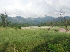
Mundal grassland in Rajaji National Park.
Tiger populations in the Terai-Arc Landscape (TAL), identified as one of the global priority tiger conservation landscapes, are centred around protected areas which comprise of only 15% of the entire landscape, interspersed within a matrix multiple-use forests, agricultural land and human habitation. The western TAL spans across 4800km2 from the Gola River in the east to the Yamuna River in the west, forming the north-western population limit of tigers in the Indian subcontinent and would comprise my study area. Encompassing the protected areas of Corbett Tiger Reserve and Rajaji National Park, this area is fragmented into two Tiger Habitat Blocks with poor or no connectivity owing to anthropogenic disturbances.

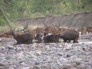
Chital and Sambar at a waterhole.
Within the western TAL, lack of data on wild prey availability from outside protected areas where livestock-mediated competition is prevalent presents a major impediment in restoring connectivity across corridors for tigers. It is pertinent to note that though livestock are also potential prey, retaliatory poisoning of tigers makes it imperative to ensure higher densities of wild ungulate prey to sustain tiger populations. Hence, it is critical to assess the habitat use of wild prey and the impact of livestock grazing on wild prey presence across the landscape, in addition to evaluating the dependencies of local communities on wild prey habitat. The objectives of this project are to:

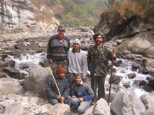
Research team in field.
(i) map wild ungulate distribution and identify areas of overlap with livestock,
(ii) assess the impact of livestock grazing on wild ungulates,
(iii) evaluate the dependence of local communities on wild prey habitats,
(iv) develop management strategies to restore corridors without undermining the interests of local communities.
Through our assessment, we hope to generate data which would facilitate in evaluating the condition for tigers across forest patches in the landscape to identify source areas, dispersal corridors and potential breeding habitats. Distribution maps of wild ungulates would help identify areas which hold the potential to support breeding tigers outside known source populations. Results of forage selection and dietary overlap between wild ungulates and livestock would be used to suggest suitable management measures to enhance the availability of preferred forage species. Thereby, we expect to aid the management in developing well-informed and socially responsible strategies to restore wild prey to ensure long-term viability of corridors across the landscape.