André Costa Pereira
Wetlands provide diverse ecosystem services and support unique biological communities. However, their conservation has been historically overlooked and they have been severely reduced worldwide. In the Araguaia floodplain, natural areas are rapidly being converted into croplands, especially irrigated rice. Using the top predator Caiman crocodilus as an indicator species and model organism, we will assess the impacts of different land uses on the impacts of different land uses on natural communities and ecosystems of the Araguaia floodplainits by means indicators of demographic status of C. crocodilus, including trophic niche, body condition, and abundance. Our results should provide landowners and managers of protected areas in the region with critical information for promoting the sustainable use of this unique landscape and the conservation of its natural populations and communities.

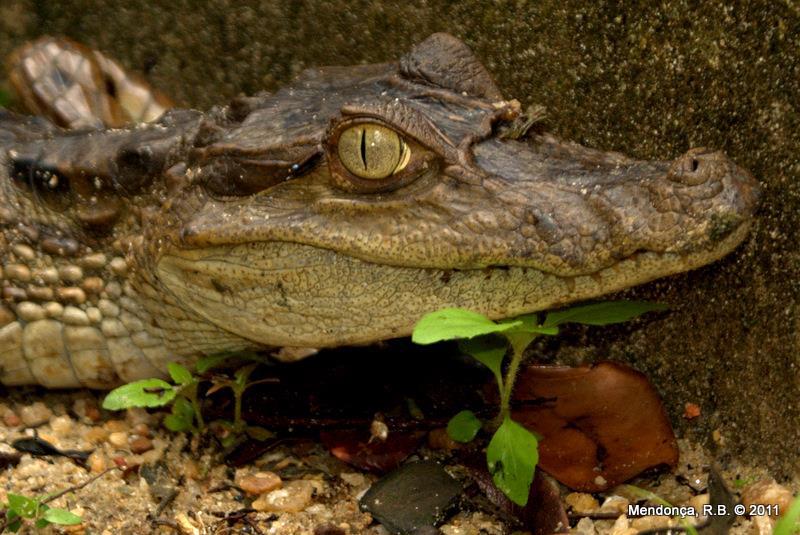
Caiman crocodilus.
The Araguaia floodplain in central Brazil is a wetland that covers ca. 90,000 km2 at maximum flood level along 5 months, sheltering a high biodiversity, including endemic and threatened species, and provide ecosystem goods and services, including water and food supply, and fertile lands. However, this region are under sustained pressure from irrigated rice cultivation. Besides habitat loss, waterbodies are being fragmented, dammed, pumped, eutrophicated and polluted, likely affecting associated species and disturbing ecosystem function. Assessments of the impacts and possible contributions of these changes upon the Araguaia floodplain biodiversity are wanting. Using the top predator Spectacled caiman (Caiman crocodilus) as model organism, the present study assesses the impacts of different land uses on natural communities and ecosystems of the Araguaia floodplain. Its role as top predator, high detectability, and its sensitivity to bottom-up environmental threats faced by communities play the C. crocodilus as an indicator species for detecting and monitoring environmental impacts.
In six localities of the Araguaia floodplain in central Brazil during July– September 2018, we will sample C. crocodilus in representative habitats (e.g. rivers, lakes, reservoirs, and irrigation ditches) of agricultural and protected areas to collect biometric data, abundance data, and tissue samples (plasma, red blood cells, muscle, nail, and scute) through nocturnal counts and captures of individuals. We will use these data for impact assessment in indicators of demographic status of C. crocodilus: Body condition - as indicative of animal health in its physiological and nutritional condition, using the scaled mass index; Trophic niche - estimated as isotopic niche using carbon (13C) and nitrogen (15N) isotopes of tissue samples, and assessed in a spatial-temporal comparative approach of niche width; Abundance – estimated from nocturnal counts using N-mixture models to reflect population dynamics and effects of anthropic disturbance. Finally, we will model the relationships between suitable landscape features and indicators of demographic status, considering factors of habitat, size, sex, and tissues on Bayesian hierarchical models.
Our results will highlight key landscape features for the persistence of C. crocodilus populations in agricultural landscapes. Such knowledge should help both landowners and managers of sustainable use protected areas to optimize the multiple uses of water supplies in the Araguaia floodplain, especially for irrigated rice cultivation, with the goal of contributing to the sustainable development of the region and supporting conservation planning and management for wetland biodiversity.