David Mfitumukiza
The project aims to contribute to the development of a rangeland pasture quantity and quality management information system for sustainable wildlife and livestock management.
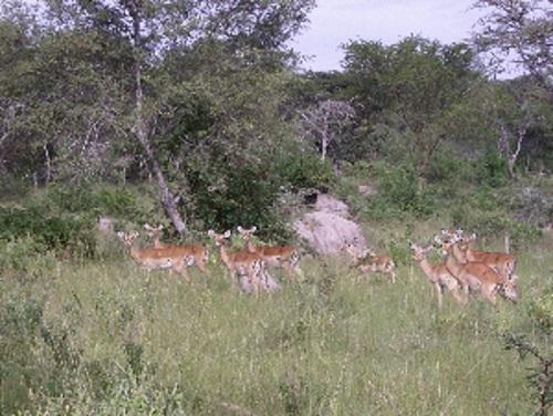
In this project we are investigating the spatial and temporal patterns of pastures around Lake Mburo Conservation area in two predominantly pastoralist sub-counties in the Ugandan ‘cattle corridor’ where the majority of the population depend on livestock for their livelihoods. The unique characteristic of the study area is the convergence of wildlife managed by Uganda Wildlife Authority and livestock owned by communities surrounding Lake Mburo National Park. Death of wild animals is very common especially during dry seasons and droughts when competition for land use and access to water and pastures is uptight. The main objective of the project is to establish the trends in pasture quality and quantity across seasons in different landscape characteristics for purposes of providing information to rangeland managers and users to come up with better management strategies.
The specific objectives of the study are to determine pasture biomass production potentials in different vegetation cover types; spatial and seasonal variations in pasture biomass quantities; and spatial and seasonal variations in pasture nutritive value, species areal cover and frequency of occurrence. Both remote sensing and ground based methods of data collection are being used in the study. Data collection is being done mainly using stratified clustered random sampling. Data being collected and/or used include vegetation species composition and structure (percentage cover, height), pasture biomass quantities, soil texture and depth, slope and rainfall.
Data integration and analysis will be done on grid basis using Geographic Information System. It is believed that this project will contribute to the realization of MDG 7 and the National Land Use Policy (2007) for Uganda by: availing land resource inventory information for decision making on land use planning and decision making. Vegetation and pasture information will also be used by livestock owners, agricultural extension workers, and wildlife managers in determining how many and when animals can be grazed on specific sites.