Social media video featuring the project.
Dhaval Patel
Other projects
29 Apr 2013
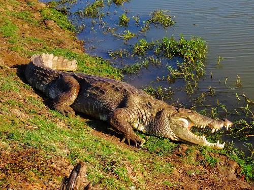
Assessing the Distribution Status and Conservation Threats of Muggers (Crocodylus palustris) in Charotar Region, Gujarat
Project attempts to understand the drivers of crocodile attack in a multivariate framework using spatial tools, as well as provide training and guidelines to the people involved in HCC management.

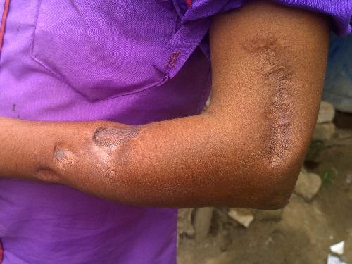
Crocodile attacks have increased over the last 4-5 years in Gujarat, thus intensifying conflicts. Of the 42 crocodile attacks reported in India in 2014, nearly 17 attacks occurred in Gujarat resulting in 12 human deaths, and the remaining severely injured. Human Crocodile Conflicts (HCC) in Gujarat continues unabated especially in Vadodara and Bharuch districts. We therefore feel the need to resolve immediate measures in order to minimize conflicts and to contain public resentment.

Conflict mitigation in this region demands a multi-approach strategy, incorporating scientific tools and local people’s active participation. Therefore this project attempts to understand the drivers of crocodile attack in a multivariate framework using spatial tools, as well as provide training and guidelines to the people involved in HCC management. Resolving HCC has become a challenging task for wildlife managers in Gujarat. Forest staff is seriously handicapped to better deal with conflict because of the lack of proper guidelines and training at various stages of HCC management (prior to attacks on people, after attacks, before/after capture). To remedy this we would like to create, publish and distribute a management document aimed at forest staff of Gujarat who has to deal with the conflict at a field level.
Using field surveys, interviews and information from the forest department records we will first assess the population and habitat utilization of crocodiles in the proposed study region and then characterize the extent and distribution of HCC. This project will use a multi approach strategy to evaluate the status and patterns of the existing conflicts and identify the key drivers behind them. This much needed information generated will be the first step for mitigating HCC and improving conservation planning at regional and state level. An essential outcome of this work would be that after mapping HCC hotspots, which will act as a guide map, and based on which site-specific conflict mitigations can be carried out. The risk maps developed in this study are useful tools for identifying factors that increase attack risk as well as facilitate policymaking and action planning in Gujarat. Once the crocodile occupied and conflict areas have been identified, we plan to reach those areas and mobilize educational and awareness programmes to follow safe practices, motivating schools children and local people through awareness to bring out positive attitude and garnering their support, empowering wildlife managers and NGO’s in mitigating HCC.