Jasper Slingsby
We are examining the impacts of invasive alien grasses and mammal herbivory on vegetation diversity and post-fire biomass recovery in two critically endangered vegetation types in lowland Fynbos of the Cape Floristic Region, South Africa. The vegetation forms the last remaining fragments of habitat used by the critically endangered Geometric Tortoise and our study will form a monitoring baseline to inform the management of both the vegetation and the tortoise.

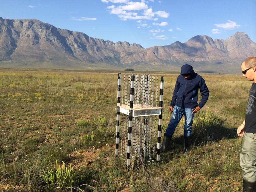
Luvuyo Dlamini (SAEON intern) and Abri de Buys (SAEON technician) test the multi mini-disc non-destructive biomass measurement technique.
The Geometric Tortoise (Psammobates geometricus), one of the world’s 100 most endangered species, predominantly occurs in two vegetation types that are themselves Critically Endangered (Swartland Alluvium Fynbos and Swartland Shale Renosterveld). Fires in January 2012 burnt the majority of the remnants of these vegetation types, believed to hold 80% of the Geometric Tortoise population (estimated at less than 1000 individuals). While fire is natural in these systems, loss of the majority of habitat in a single fire is catastrophic for the population. Invasive alien grasses and indigenous large mammal herbivory affect post-fire recovery and alter the composition, structure and function of these vegetation types with unknown consequences for tortoise habitat quality. Similarly, little is known about the tortoise’s habitat requirements in terms of diet, cover or nesting sites; or the time it takes for the vegetation to recover these properties post fire. Our study will explore the impacts of alien grasses and herbivory on the recovery of plant diversity and vegetation structure after fire to inform in and ex situ conservation and management of the tortoise and its habitat, and provide valuable baseline information for future research.
We will 1) explore impacts of invasive alien grasses and mammal herbivory on vegetation diversity and biomass recovery post-fire using vegetation survey techniques; and 2) Collect specimens of all plant species surveyed. These allow development of DNA barcodes that are valuable for plant conservation and taxonomy, and for inference of tortoise diet by DNA analysis of scat. Finally, the vegetation plots are designed to provide groundtruth data for remotely sensed imagery, allowing many applications such as mapping of the two vegetation types and alien grass invasion by image classification and/or statistical comparison of post-fire recovery profiles, and fire risk management. Plots will be maintained for long-term monitoring of post-fire recovery, global environmental change impacts and effectiveness of management interventions.