Rodolfo Cervantes Huerta
The main objective is to determine the effect of vegetation type, the structural attributes of the road and the inclination and roughness of the land where it was built on the presence and mortality of fauna to develop a method to improve mitigation measures, such as road-crossing structures, of the harmful effects on fauna for the roads already built and for the planning of new roads.
Once the magnitude of the influence of the intrinsic attributes of the terrain and road studied in this work has been determined, these will be included in two equations that allow us to know and predict the impact of all road sections on wildlife.

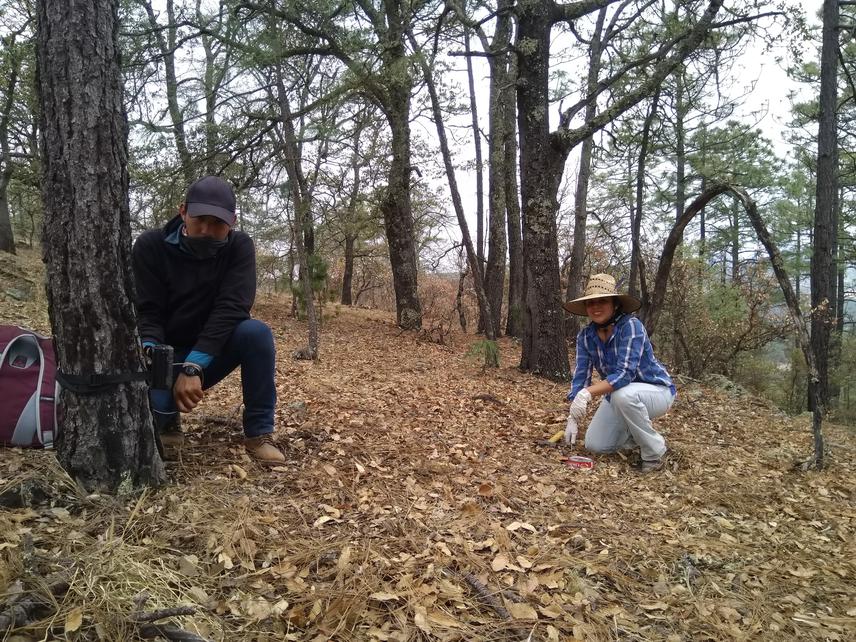
MSc. Jessica Duran-Antonio assisting the undergraduate student in the placement of camera traps
The destruction of habitats caused by road construction creates a barrier that limits the landscape connectivity and threatens the persistence of wildlife. At the same time, the landscape connectivity can be affected by the presence of road infrastructure, such as culverts, bridges or walls that facilitate or limit the flow of fauna through the road.
The construction of this infrastructure is determined by the topography of the site through which the road passes. This will determine safe passages for wildlife or sites where there will be more roadkills and where the barrier will be insurmountable and will isolate populations on one side of the road.
On the other hand, the effects caused by the roads reach beyond the asphalt. Factors such as light and traffic noise, penetrate the adjacent habitat, altering habitat use by wildlife.
We aim to determine the effect of vegetation type, the structural attributes of the road and the relief of the land where it was built on the presence and mortality of fauna to develop a method to improve mitigation measures of the harmful effects on fauna for the roads already built and for the planning of new roads.
The study is carried out on Mazatlán - Durango highway, in the states of Durango and Sinaloa, Mexico. The road section to be studied starts at kilometer 33 and ends at kilometer 172, it crosses the Western Sierra Madre mountains of Mexico where there are temperate forests and, to a lesser extent, some areas with induced vegetation and agricultural or livestock areas.
To evaluate the effect of the road on wildlife, a square kilometre will be sampled on each side of the selected sites. Signs of presence of fauna will be sought to know how habitat use changes due to the effect of the road.
Low speed vehicle tours will be made in search for signs of wildlife remnants on the road. The species and the coordinate will be registered for its subsequent relationship with the characteristics of the site.
The influence of the characteristics surveyed and those reported in the literature will be incorporated and weighted according to two new equations. These will be tested with the data obtained in the samplings of this project and other projects to adjust the weighting and verify its veracity.