Vestine Ingabire
Prunus africana has a wide distribution in Afromontane regions of Africa. It is a canopy tree of 30–40 m in height, found at 900–3,400 m above sea level. It has been declining in its geographical range due to unsustainable harvesting of the bark for its medicinal properties. Furthermore there is data deficient of this species in Rwanda. In this regards, the project aims to provide baseline information about population status, threats and spatial distribution of P. africana in Rwanda. This information will be used in designing suitable monitoring programmes and to curtail unsustainable exploitation of P. africana. Furthermore it will help government’s plans in the management of protected areas and sustainable utilization of natural resources by influencing policy decision making process.

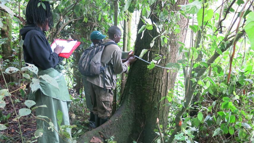
Diameter breast height measured, in Nyungwe National park.
P. africana has a wide distribution in Afromontane areas where it provides multiple uses for people. Now days, P. africana is declining from its natural range in some countries and it is listed as Vulnerable by International Union for Conservation of Nature (IUCN 2016).This has prompted many studies to seek to track changes in the species’ abundance over time. Most studies that have been done demonstrated high decline rate due to the uncontrolled exportation of Prunus africana bark, where they are used by the pharmaceutical industry and resulted in the species listing in Appendix II of CITES. In Rwanda, diverse scientist’s studies on biodiversity have suggested the occurrence of Prunus africana in some of the National parks. However, there is lack of information on distribution, abundance, and threats to this species.
The main objective of the study is to assess the abundance, distribution and threats of P. africana in Rwanda. Survey will be conducted in 2 sites (Nyungwe, Gishwati-Mukura national parks) and each site will be surveyed 2 times (different seasons). Random sampling will be used based on disturbance gradient, assuming higher disturbance near forest edges. For each site, 5 belts transect each measuring 50m width and 500m length will be established perpendicular to the altitudinal gradient. Moreover, the interval between belts transects will be 100m whereas 20 m will be the distance from one plot to another. Twenty-six (26) plots will be provided from each belt transect. Furthermore, direct observation procedures will be applicable in order to evaluate the process event or situation of physical outcomes and interviews will be used to determine details on threats.
The project will provide baseline information on abundance, distribution and threats of P. africana in Rwanda, which will help to develop management plan of this species at national level and will lead Rwanda to be in partnership with other range countries for taking in active measures to conserve this species. Furthermore, information will contribute to the implementation of National Biodiversity Strategic Action Plan (NBSAP) through sharing the information to the concerned institutions.